Trukhanov Island on the Dnieper has an area of 450 hectares and is located opposite the central part of Kyiv between the main channel of the Dnieper in the west and its branch Chertoroy in the east, includes Park Muromets. It is believed that the name of the island comes from the name of the Polovtsian Khan Tugorkhan, since at the end of the 11th century it was the residence of his daughter, the wife of the Kyiv prince Svyatopolk Izyaslavich. During the time of Kievan Rus, there was also a settlement of Olzhishi on Trukhanov Island, which belonged to Princess Olga. In 1534, the island passed into the possession of the Pustynno-Nikolsky Monastery (in the 1960s it was finally destroyed and dismantled at the direction of the USSR government and the Communist Party of Ukraine), in 1698 it was returned to the city. In the middle of the 19th century, the first buildings appeared on it, in the 1880s workers’ settlements arose in connection with the creation of the 1st and 2nd associations of the Dnieper Shipping Company on the island. Shipyards, a yacht club, the Hermitage park were located here, in 1895 a telephone appeared – a connection was made to the dacha of the shipping magnate David Margolin. In 1907, the city council allowed the island to be populated. By that time, 130 self-settlers who worked at the shipyard lived on it. Quite quickly, a central market square (Zaporozhskaya) was built on Trukhanov, streets with geographical names were laid: Dneprovskaya, Konotopskaya, Poltavskaya. In 1909, a school-college was built with Margolin’s money, and in 1910, the stone church of St. Elizabeth was consecrated in honor of Elizabeth Trepova, the Kyiv governor-general who helped with the construction.
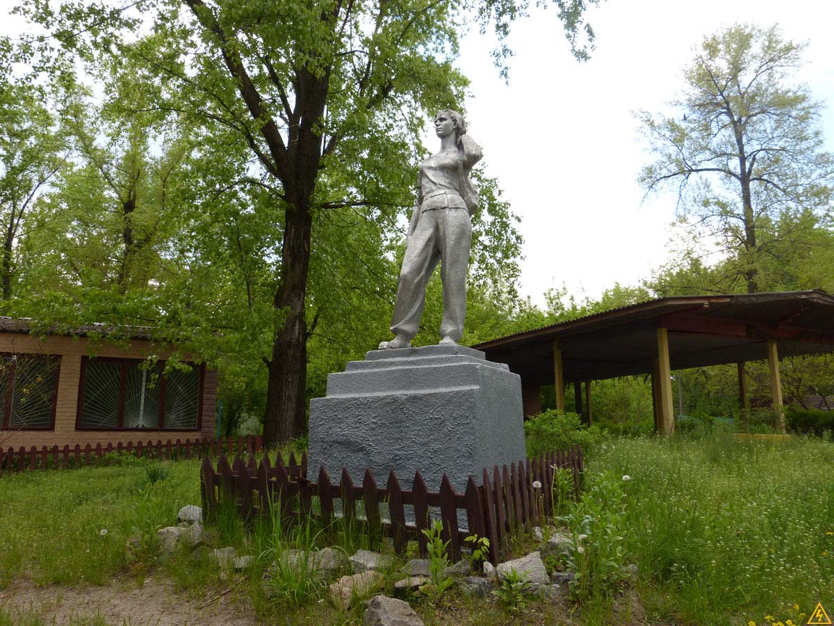
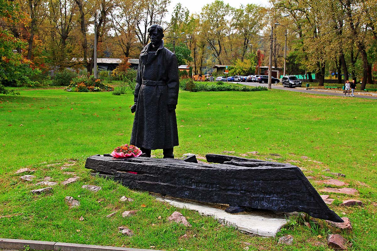
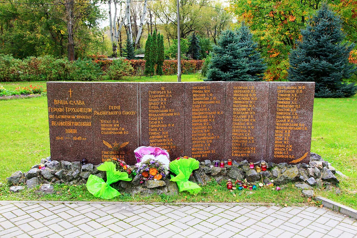
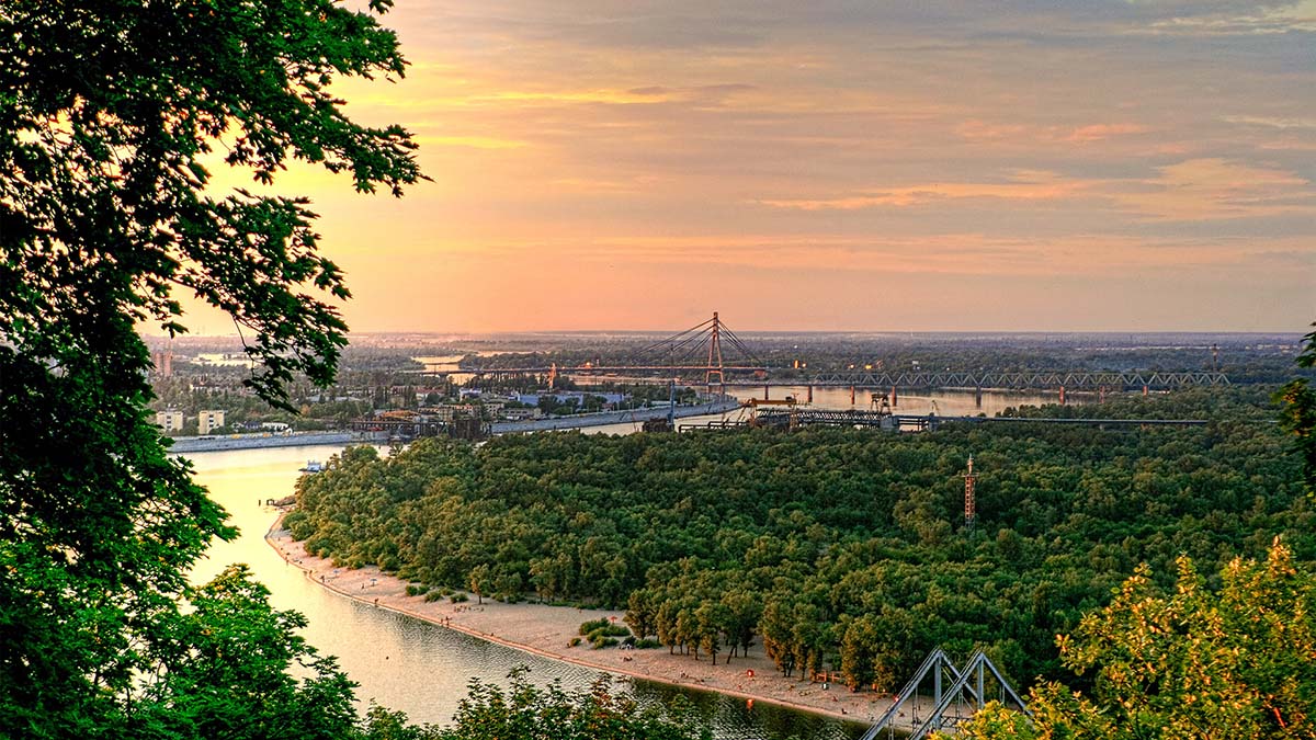
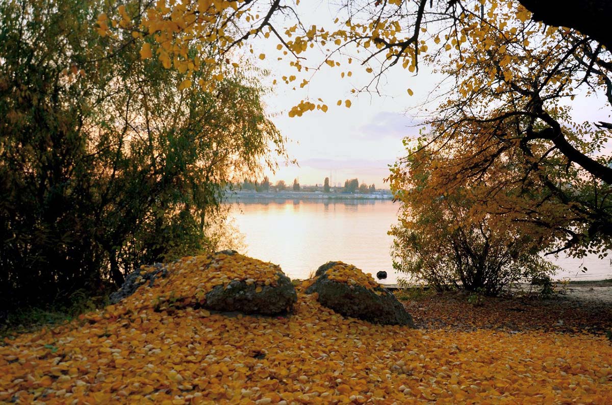
The now famous beach on Trukhanov Island was first opened in 1918 during the years of the first German occupation. After the destruction of the settlement during the Second World War (in memory of the Trukhanovites who died at the front in 1989, a memorial was erected here), Trukhanov Island was rebuilt into a vacation spot – now there are large beaches, water stations, sports facilities, restaurants, rest houses and various entertainment institutions. Trukhanov Island is well landscaped and is connected to the embankment of the right bank of the Dnieper by park footbridge (250 meters before the entrance to the bridge, on the right, you can see the famous Kiev landmark monument of the baptism of Rus’/column of Magdeburg law), which was built in 1957. Before the blocking of the Dnieper by the dam of the Kyiv hydroelectric power station (1964), Trukhanov Island was completely flooded during spring floods.
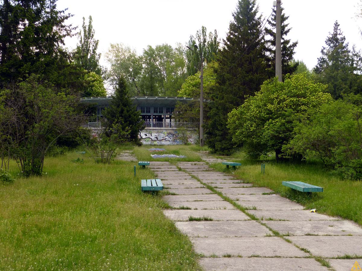
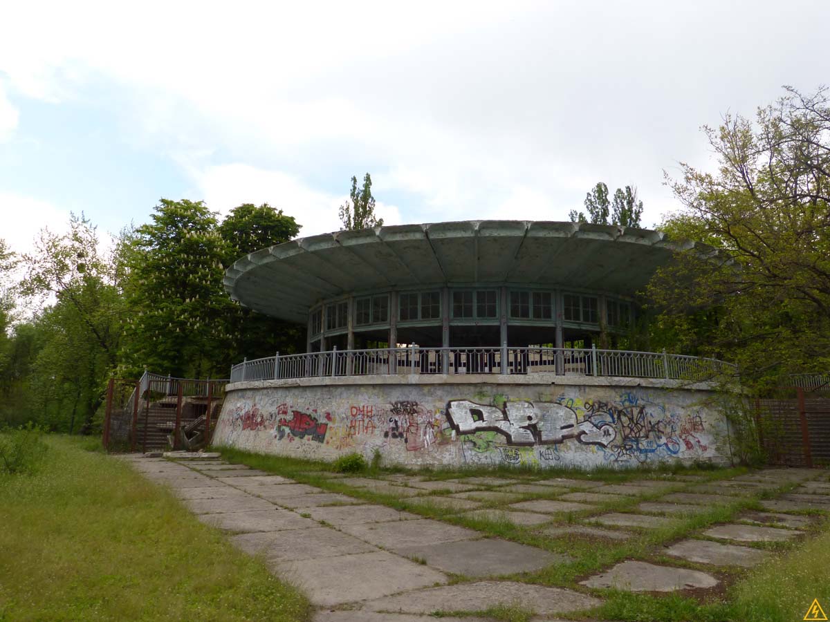
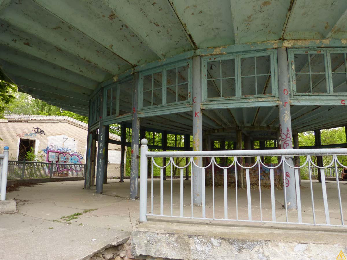
On Trukhanov Island, in addition to recreation, you can also play sports. Since 2014, a bike path has been built through the island. Everyone can run there, ride a bike or rollerblade, or engage in other types of sports activities. Trukhanov Island is located near Matveevsky Bay, which is the only bay in Kyiv where athletes train in rowing on boats “Dragon”, rowing and rowing in kayaks and canoes. There are many sports bases here, such as: Zenit, Lokomotiv, KPDYu, CSKA, Burevestnik, DYUSSH7, Spartak (DYUSSH Kyiv) and others. Closer to the metro bridge, in the recreation area “Dovbychka” there is a nudist beach. At 400 meters from the entrance to the island, if you move straight ahead, there is the building of an abandoned Soviet cafe-dance floor “Vidpochinok”. Previously, citizens who lived on the left bank of Kiev had the opportunity to get to Trukhanov Island by tram along the Dnieper embankment, but after its abolition, there was only one convenient way left – by metro to the Postal Square station, and from there – on foot.